Sunrise I started my trek at 600m altitude in Granada. It took 30km and 6 hours to reach Sierra Nevada and the ski slopes. This point was at 2000m altitude.
After having a snack I kept going with the goal to reach the peak and head towards the highest city in the Hispanic mountains, Travelez.
Little did I know, this would take longer than I thought due to terrible weather conditions.
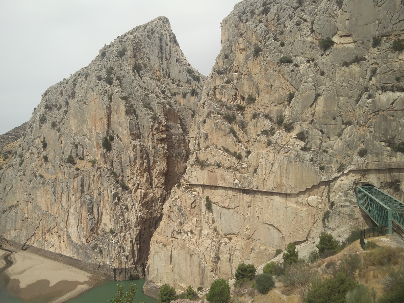
Once I started the hike from Sierra Nevada, the weather turned really windy and misty. After every step upward, there was less and less vegetation. Soon I would reach 3000m in altitude and it was raining with very little visibility.
My raincover doesn't cover my whole backpack so this doesn't help.
Yes, I was hiking this whole trek with a 12kg backpack! The highest point I reached was 3300m, this was just past the highest point of the ski slopes where the chair lifts go. I couldn't see anything beyond 10 meters.
I met 2 trekkers in a building that said they were camping the night. It was still sunny outside so I kept going, but little did I know I was in for a disaster.
The winds were really strong, the temperature was really cold. The temperature dropped from 30 degrees in the city, to 8 degrees at the peak.
The winds were so strong, there were some rock slides only a few meters away from me. It was pretty scary, so I began to pick up my pace. I was hit with hail multiple times during this trek.
The 3rd time it hailed I had to cover my head because the size of the hail was hurtful.
12 hours has past and it became dark, and I was still above 3000m in altitude. There were thunderstorms with lightning on either side of me for hours with some breaks in between.
The lightning was so close that at moments I had to stop and get close to the ground. By this point I'm all wet, carried wet clothes in my backpack.
I have 3km left to get to Travelez, running almost blindly with my headlamp, following the streams of water. The shortcut to town lead through some farmer fields with private fences.
I had to get my way around some barbed wire, mud slides, and bushes with thorns that ripped up everything. I slipped a number of times during this last leg of the trek.
at 23:00 I managed to get into town, alive. This whole rekt took me 15 hours and 60km, with 3500m in vertical ascent!